Yosemite north of Hetch Hetchy offers solitude where few explore
Tom Stienstra - San Francisco Chronicle - July 19, 2012
At the brink of the Grand Canyon of the Tuolumne, our first glimpse of Hetch Hetchy below set off sensations of awe, ghosts and thrills.
In early evening, a thick sky and refracted light tinted the canyon with a muted opaque glow. The air was warm and humid. Our packs felt lighter than in days, knowing the end of a 35-mile trek was a few hours off.
Across the lake, 5,772-foot Kolana Rock, like Half Dome's little brother, towered over the canyon. On the north rim, massive LeConte Point rose up like a second El Capitan. Ahead we could make out the feathered wisps of Wapama Falls, like a hidden Yosemite Falls.
Below was one of the prettiest lakes in California, Hetch Hetchy Reservoir, owned and operated by the city of San Francisco. Before the 312-foot dam was constructed to provide water and electricity for San Francisco, the canyon was a second Yosemite Valley, one of the showpieces of the world.
John Muir lost the battle against the dam in 1913. Many say he died of a broken heart the next year.
As you descend into the canyon, you might feel the shadow of Muir's ghost looming over the lake, or that of the men who lost their lives when they built the linked pipeline, or perhaps the two backpackers who were swept off a hiker's bridge last spring by flooding outflows of Wapama Falls.
Hetch Hetchy and the nearby wilderness is the hidden Yosemite, where a handful of adventurous souls trek to little known lakes, ridges and valleys.
In the wilderness north of the lake, it's common to have pristine lakes all to yourself at small, intimate camps. Yet just over the ridge, in Yosemite Valley, more than 20,000 people can jam into 7.5 square miles every day of summer, with all the parking spaces gone by 9 a.m.
Five years ago, the Department of Water Resources completed a study that said it was feasible to drain Hetch Hetchy and restore a second Yosemite Valley. This month, the organization Restore Hetch Hetchy, supported by three former Yosemite superintendents, turned in signatures to put a measure on the November ballot that would require the City of San Francisco to come up with a plan to do that. If approved, another measure would then appear in 2016 that would require the plan be implemented by 2035.
Nobody argues with the need for the water. The premise is that it doesn't need to be stored in a national park.
Last week, a group of four of us took off on an expedition into the Yosemite wilderness above Hetch Hetchy and to descend into the canyon as if simulating the experience of the trailblazers of the 1800s. The Furniss clan of explorers, hydrologist Michael Furniss, son Liam, and nephew Chris, all with advanced science degrees, were eager to see the hidden Yosemite.
Call of the wild
The idea for the trek came years ago, the first time we hiked the John Muir Trail, from Mount Whitney to Yosemite Valley, and felt the shadow of Muir in many of our steps. Many on the JMT know this. It's something that doesn't go away.
That imprint was still fresh when the time was right last week. We secured a wilderness permit, limited to 25 per day for the trailhead, outfitted and readied our gear and backpacks, and then drove out and left my truck at the end of the trail.
We then shuttled to the Cherry Lake Trailhead in adjoining Stanislaus National Forest for our launch point, set at an elevation of 5,000 feet. With a huff and a puff near dusk, we were off to nearby Lake Eleanor and beyond, excited at what was ahead.

After a short first-day hike at dusk to Lake Eleanor, the first camp, we covered 17 miles and climbed 3,000 feet in two days with camps at Laurel Lake and Lake Vernon. In one 50-hour span, we saw one rattlesnake, two bears (they both scampered off), heard another at night (it took off when I called out, "We have company"), and here in a state with 37.7 million people, encountered no one on the trail except a sole ranger.
This is Yosemite? One of the most popular parks in the world? At peak season in July? That's right: two days and not a single other camper anywhere at three of the prettiest lakes in the Sierra.
At night at Eleanor, we heard the mating call of a Sierra spotted owl, then at Laurel, the haunting, extended hoots of a great horned owl. With no moon and a dark, clear sky, the plethora of stars - sparkling diamonds everywhere - made it difficult to identify constellations.
At dawn, about 20 yards downslope from my bivy, nestled on a forested peninsula at Eleanor, I heard the tale-tell click-click-click of a rattlesnake. Sure thing, about a 4-footer had set up its base station nearby. He clearly made his living here, most likely when the chipmunks showed up to raid any camper goodies that hit the dirt by accident.
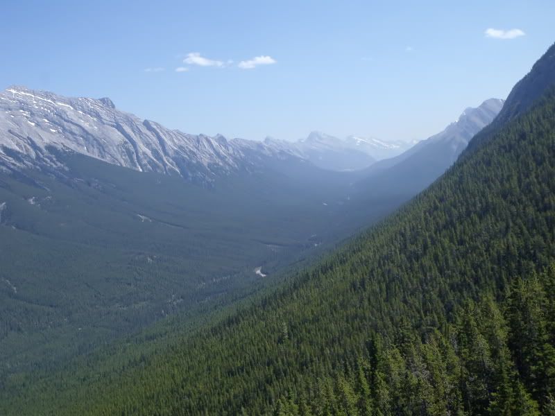
We climbed up the foot of Moraine Ridge, then departed from the forest and walked into a vast, glacial-carved valley at 6,500 feet elevation. We found Lake Vernon tucked against a high ridge. Pristine and gorgeous.
"Some 20,000 years ago, the canyons of the Sierra were filled with ice nearly a mile deep," said Michael Furniss, whose highest expertise is in soils. "This and other ice ages carved out these awesome valleys. The ice was gone by about 10,000 years ago."
Muir, who graduated from the University of Nature, was the pioneer in glaciology who is credited as the first to determine that glaciers carved Yosemite's deep canyons.
Valley descent
We awoke at dawn at Lake Vernon. The air was cool and it was so quiet you could practically hear the flowers bloom. The morning trek climbed 1,100 feet for a stunning view of the granite valley, and then emerged on a forested ridge on the flank of 8,412-foot Mount Gibson.
Instead of a view, the trail burrowed through a grotto of waist-high bracken ferns and under a pine forest, and then ran aside a meadow adorned with thousands of wildflowers. Muir called such a meadow "a bee garden," with mule's ears, shooting stars, lupine, columbine, Indian paintbrush, milkmaids, parsnip and so many others. For an hour, it felt like 1868 when Muir first walked these mountains.
Suddenly, the trail broke from forest and extended to a sub-ridge that faced an open valley, and in the distance emerging in front of us, was the Grand Canyon of the Tuolumne that led to the Hetch Hetchy Rim.
In a span of 5 miles, we dropped 3,000 feet to Rancheria Falls and its swimming holes, and continued
through a notch in the north wall, on the precipice of paradise.
Within a mile, the first glimpse of Hetch Hetchy appeared ahead. The lake was still, and despite a faded sky, the water was indigo blue and seemed to hide secrets and mysteries.
The face of Kolana Rock rises up from water's edge and seems to poke a hole in the sky. Smith Peak, at 7,751 feet, towers directly across the lake.

The trail follows a thin line of conifers that runs along the foot of the north wall of the reservoir. In some spots, crews have blasted out rock and then carved and positioned rock steps like giant puzzles made out of granite.
Step by step, for 6.5 miles, you pass along the lake toward the dam and the end of the trail. Each moment provides a new glimpse of Hetch Hetchy and its landmarks, and you circumvent Kolana Rock in a curve on the far side. As you near Wapama Falls, you pass the base of 6,197-foot Hetch Hetchy Dome. Any moment, you might expect the specter of Muir to appear.
At the base of Wapama Falls, now reduced to thin summer flows, you can scramble below the hiker's bridge and scoop up some of the sweetest tasting water on the planet. It is the same water that makes its way to Crystal Springs on the Peninsula, and after treatment, to the faucets in homes in San Francisco, the Peninsula and many others in Santa Clara and Alameda counties.
From our rock perch, we drank all we could hold, amazed at its cold, fresh, natural sweetness, and then took in the view once again and scanned toward the dam: 2.4 miles and the trip would be over.
"You can see and feel deep time in this canyon," said Michael Furniss, "yet relatively few even know there is a second Yosemite Valley, and it's here under water."
Somewhere off in the distance, as we hoofed down the trail toward my truck, I felt the presence of Muir's words ring in the air.
"Hetch Hetchy Valley, far from being a plain, common, rock-bound meadow, as many who have not seen it seem to suppose, is a grand landscape garden, one of Nature's rarest and most precious mountain temples."
If you want to go
Park entrance fee: $20 per vehicle, good for a week.
Wilderness Permit cost: Free wilderness permits required for overnight stays in Yosemite Wilderness; for trailhead reservation through Yosemite, $5 per person plus $5 for confirmed reservation.
Wilderness Permit/Cherry Lake Trailhead: Reserve 24 hours ahead of time (Saturday for Monday) through Groveland Ranger District, Stanislaus National Forest, (209) 962-7825.
Wilderness Permit/O'Shaughnessy Dam Trailhead: Reserve up to 24 weeks in advance through Yosemite National Park; download PDF reservation form at nps.gov/yose/planyourvisit/wpres.htm, then fax to (209) 372-0739. Info: (209) 372-0740.
Bear-proofing food: Bear canisters are required for food storage in wilderness; rentals available at park entrance kiosks for $5 per week.
Trail map: "Hetch Hetchy Trail Map," $8.95, Tom Harrison Maps, tomharrisonmaps.com.
Contacts: Yosemite National Park, (209) 372-0200, nps.gov/yose; Stanislaus National Forest, Groveland Ranger District, (209) 962-7825, www.fs.fed.us/r5/stanislaus.
Bonus tips
A few things we did to make our trip easier:
Car shuttle: So we could hike a one-way trip and thus start and end at different points and descend into Hetch Hetchy, we left a vehicle at the end of the trail near O'Shaughnessy Dam, then drove to a trailhead on the east side of Cherry Lake.
Water purification: We used Steripen water purifiers, which use battery-powered ultra-violet rays, and thus were able to drink cold stream water in 90 seconds without pumping, chemicals or boiling.
No twisted knees: Three of four people in our party (not my thing) used hiking poles for additional stability on the trail.
Nearest drink: When you finish the trip, the nearest cold drink and snack is at the little store at Camp Mather (friendliest folks you ever met); (209) 379-2284; campmather.com.
Nearest restaurant: Evergreen Lodge, a short distance down the road from Camp Mather, has a top-notch restaurant and bar (buffalo burger with cheddar cheese borders on the awesome); (209) 379-2606, evergreenlodge.com.
Best breakfast on the road: The little cafe just past the top of Priest Grade on Highway 120 near Big Oak Flat is the best around (the scrambles are mouth-watering great); Priest Station Cafe, (209) 962-1888.
- Tom Stienstra
How to get there
From San Francisco to Groveland: Take the Bay Bridge (get in right lane) across to the split with Interstate 580. Bear right on I-580 East and go 46 miles to I-205 East. Take I-205 for 14 miles to I-5 North merge, and go 2 miles to the exit for Highway 108/120 to Manteca/Sonora. Take that exit and drive about 47 miles (stay on 108/120 at signed junctions when driving through towns) to the exit for Highway 120/Groveland. Bear right on 120 and drive (newer vehicles take shortcut up Old Priest Grade) through Big Oak Flat to Groveland.
Groveland to Cherry Lake Trailhead: Take Highway 120 east for 14 miles to Cherry Lake Road. Turn left and drive 24 miles (paved, but twisty and narrow in spots) to a junction at Cherry Lake. Turn right and drive 1 mile to the dam. Turn left (road turns to dirt), drive over dam for a half mile to another junction. Turn left and drive 1 mile to a signed trailhead (on right), and parking and primitive campsites (on left).
Groveland to O'Shaughnessy Dam/Hetch Hetchy Trailhead: Take Highway 120 east for 22.5 miles to Evergreen Road (signed for Hetch Hetchy). Turn left on Evergreen Road and drive 7.4 miles to Hetch Hetchy Road. Turn right on Hetch Hetchy Road and drive 9 miles to the dam and trailhead; at park entrance, ask ranger for overnight parking permit and location of backpacker's parking.
'Tom Stienstra's Outdoor Report' can be heard Saturdays on KCBS (740 and 106.9) at 7:35 a.m., 9:35 a.m. and 12:35 p.m. E-mail: tstienstra@sfchronicle.com. Twitter: @StienstraTom
.